Thursday, August 29, 2013

Top Ten Listing Mistakes

As an agent who scours listings for potential clients there are features and descriptions that draw one in. There are very effective marketing tools, pictures and descriptions that help potential buyers notice a house or property.  There are also features in listings that make one question why they are there. This is a list of the top 10 mistakes seen in listings.

1. Blurry pictures taken with a cellphone. Not only are these disappointing, they are unprofessional.

2. Personal items appearing in pictures like medicine bottles, dirty dishes, open toilet lids and piles of what appears to be dirty laundry. Not only can this make a poor impression on a buyer, it could be dangerous for the homeowner.


3. Green/brown or only slightly filled pools. If the first thought that enters one's mind after seeing a picture of a pool is an opossum on an inflatable ring enjoying the pool, it is not listing worthy.


4. Misspellings. If an agent doesn't take the time to spell check a listing are they going to take the time to comb through a purchase and sales agreement for simple mistakes? 

5. Words and phrases the average person is unfamiliar with. For example lavette, I had to look this one up! It means small bathroom, a derivative from the French word lavatory or what most people call a small bathroom without a tub or shower.

6. Shorthand that appears in the comments section. EIK, eat-in-kitchen or FP, for fireplace, they make sense once you are familiar with them but they can confuse and frustrate buyers.

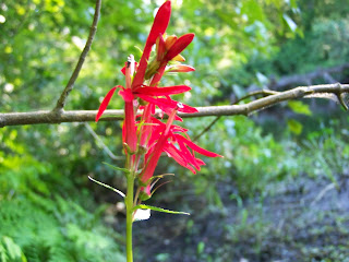
7. Pictures only featuring flowers. I have nothing against flowers, but generally they do not belong in a listing.


8. Random pets. Pets are great, but unless they photobomb the picture they too do not belong in a listing. They are a very cute and cuddly distraction from design features (I got distracted just thinking about them).

9. Cars in the driveway. They can block the view of the house.

10. Mislabeling outbuildings. Sheds, barns, running sheds, potting sheds, chicken coops and garages are not interchangeable words. Each has a unique design feature that while can be changed, for example a barn can be converted into a garage, but until that change happens it is still a barn.

Monday, August 5, 2013

SOLD! Southern RI Housing Stats


While housing markets across the country have seen double digit increases in housing sales, RI has seen only a 1% increase. RI, unlike other states was not hit as hard by the housing bubble of 2008. In southern RI the second home market and demand of homes cushioned the housing market somewhat.

From June to August 6 homes in Richmond, Charlestown and Hopkinton were sold in the price range of $100,000 to $200,000. This is the typical “bottom of the market” or first time home buyers range for these towns. This number excludes short sales.

What is interesting about these numbers is the number of days these homes were on the market. The longest was 62, the shortest was 1. Not only are homes in this price range selling, they are selling very quickly. The average was 23 days on the market.

For sellers this means pricing a home in this range may lead to an expedited sale. Good news for those who may want to move before the start of the school year, or who want to move quickly. For sellers who are priced slightly above this price range, a price reduction may help sell their home.

Buyers in this price range will have to keep up to date on this market. With homes selling quickly buyers need to be ready to view them, have their mortgage commitment letters ready and be ready to make an offer quickly.

Are you or is someone you know looking at homes in this price range? If so they need an agent who understands this market and will help them meet deadlines and get ready to put in an offer that may get accepted in this competitive market.

Monday, July 1, 2013

Be Smart About Town Tax Rates

Rhode Island was established in 1636. That means there is almost 400 years of history behind it's towns and counties. The borders between towns are as old as the founding of Rhode Island and reflect the history that made them so.

The smallest state, like many New England states has many small towns each operating differently with differing taxes.

If you are contemplating retiring, moving a family or are just curious about how your town compares to others here is tax information for Rhode Island towns. This will help homebuyers make the smartest, most educated move.

These can also be found at riliving.com or view my earlier post here.

Per $1000 of assessed value.

Tax Table
Tax Table
*Source for the list was the Rhode Island Department of Municipal Affairs for year 2012

Friday, June 28, 2013

Family Activities: Fishing Carolina Trout Pond

Carolina Trout Pond located off Switch Road in Richmond, Rhode Island offers some of the best bank fishing in southern Rhode Island.
Pond
Carolina Trout Pond
Photo Courtesy Rebecca Crosby All Rights Reserved
Carolina Trout Pond is a great place to take the whole family fishing. It has picnic tables and somewhat level banks for fishing. Kids can fish and as they get distracted or need to take a break the can explore the unique eco-system around the pond.
Grasshopper
Grasshopper
Photo Courtesy Rebecca Crosby All Rights Reserved
There is no boat ramp for Carolina Trout Pond, and there are no boats allowed.
The pond has bass, crappie, sunfish, blue gill, pumpkinseed and is stocked with trout.
Red-Winged Blackbird
Photo Courtesy Rebecca Crosby All Rights Reserved
The pond is very busy on Opening day and can continue to busy that first week of the fishing season.
Take the family for the afternoon and enjoy all that Carolina Trout Pond has to offer.
Flowers
Black-Eyed Susan's
Photo courtesy Rebecca Crosby All Rights Reserved
Any persons 15 years or older require a fishing license in the state of Rhode Island for more information see the RI Freshwater Fishing Guide on dem.ri.gov
Resident freshwater fishing license - $18
Non-Resident freshwater fishing license - $35
Trout stamp - $5.50

Wednesday, June 26, 2013

Hiking Beach Pond

Sitting directly on the RI/CT line lays Beach Pond State Park. Beach Pond has the distinction of being the only pond in RI that does not open on the second weekend of April for fishing like every other stocked pond, instead fishing is allowed when CT has opening day. Hiking on the Rhode Island side of the pond offers a variety of breathtaking views.
Beach Pond
Beach Pond Trail
Photo Courtesy Rebecca Crosby All Rights Reserved
Beach Pond State Park is located in Exeter, Rhode Island and Voluntown, Connecticut.
Parking is located in a small parking lot directly off route 165 (Ten Rod Road), or across the street at a better maintained parking area that was intended for Beach Pond.
The pond is split by route 165 which was built over the pond. The southern and northern halves run perpendicular to the RI/CT state lines. Each half has a bank in RI and a bank in CT. The southern half of the pond has a trail that circles 2/3 of the pond and is a beautiful hike.
The trail difficulty is moderate due to the narrowness of the trail and the steep inclines. It can be hiked in less than 2 hours.
The trail is a narrow walking path that runs through the hardwoods and pine woods. It follows the edge of the pond and climbs a beautiful rocky bluff directly overlooking the pond. From here the path continues along the edge, there are fishing areas through here and it is reported that small mouth bass can still be caught here.
Rock Outcropping
Rocky Outcropping
Photo Courtesy Rebecca Crosby All Rights Reserved
The trail veers away from the pond and cuts through some small rocky ridges in the woods. It crosses a private road and continues through the woods until it meets route 165 in CT. Hikers will then have to walk on route 165 back to the parking area.
Rocky Outcropping
Rocky Hill
Photo Courtesy Rebecca Crosby All Rights Reserved
Disclaimer, I hate hiking on roads. This is one of the only trails that I turn around at the private road and track back to the parking area.
This hike will take hikers around a beautiful pond with a spectacular bluff overlooking it. There is a perfect place along the trail to take dogs and let them swim in the sandy-bottomed clear water. Get out and enjoy!

Monday, June 24, 2013

"It's Hot" Summer Activities

Local weather forecasts call for 3 consecutive days in the 90's. Inevitably, the proclamations "I'm hot" or "I'm bored" will be uttered by children and adults. Here is a list of some fun and cool places to take the family or friends that will put an end to those hot day statements.

Fresh Water swimming at Burlingame. The park has an active duty lifeguard from 9:00 am to 6:00 pm. There are picnic tables available and a beach. According to the State of RI Parks and Recreation, Burlingame manager parking is free at this area, but there is a $2.00 fee to use a picnic table. It is located off Sanctuary Road in Charlestown, RI.

Map
Burlingame Swimming Area
Map Courtesy Google Maps
 
Local libraries have air conditioning and it is a great way to get a jump start on summer reading. Most have internet access and summer  programs for children. Every town in Southern RI has a library. For library links see below.

Strawberry picking at local farms. Local farms like Schartner Farm offer pick-your-own strawberries, but the season is almost over so hurry! Schartner Farms is located at One Arnold Place in Exeter, RI 02822, directly off route 2.

These activities should help anyone who has to answer, "I'm bored" or "I'm hot." There are so many summer activities in southern RI so take advantage of living here most of these activities are free or relatively inexpensive. 

Here are some great web sites for more information.
riparks.com
schartnerfarms.com
langworthylibrary.org
clarklib.org
crossmills.org

Friday, June 21, 2013

The Wood River Kayaking & Canoeing Guide

This post will concentrate on kayaking or canoeing Wood River from Arcadia Management Area on route 165 in Exeter to Barberville Dam. This area has a class 1 and class 11 stream rating according to Rhode Island Division of Parks and Recreation.
River
River
Courtesy Rebecca Crosby All Rights Reserved
Parking is available at the Deer Check station located on route 165. Restroom facilities are located there also. A second vehicle can be parked at The Wood Pawtucket Watershed Association located 203 B Arcadia Road, Hope Valley RI 02832.
This trip may take 3 hours, depending on how busy it is and how high the river is.
From the Deer Check Station the river winds through Arcadia Management Area. From route 165 the river runs parallel to Summit Road and Blitzkrieg Trail. Here the river is narrower and runs slightly shallower and faster than it dos near the Barberville Dam.
The river begins to open at Frying Pan Pond. Here some houses are spread along the banks. On sunny days snapping turtles can be seen in the shallows and dry areas sunning themselves. Otters have been spotted occasionally too. This part of the river is home to trout, bass, sunfish and pickerel. Wood Turtles have been spotted along the banks.
Heron
Great Blue Heron
Photo Courtesy Rebecca Crosby All Rights Reserved
The pond ends at the dam with The Wood-Pawtucket Watershed Association on the right. There is a dock in front and a place to take-out. There is also a parking lot and portable restroom facilities.
Fishing
Fishing on River
Photo Courtesy Rebecca Crosby All Rights Reserved
The Wood River winds through amazing scenery and is home to many animals and plants. It can be a fun outdoor activity for the whole family.
For up to date river reports and conditions visit wpa.org
*Please note that 1 life vest is required for each person.

Wednesday, June 19, 2013

Ready to Buy, Now What? 3 Things Every Buyer Should Know

This past week I have twice answered the question, "I think I am ready to buy, now what?"  At some point every homeowner has been at this point. They may have done some research, or think they now where they would like to buy a home, but don't know where to begin.

1. Find an agent. A good agent will be able to point you in the right direction and counsel you through the steps. An agent will help build the team of professionals it may take to get a buyer into a home.

2. Pre-Approval. The first question most agents ask is "are  you pre-approved?" In the age of internet  listings and online mortgage applications first time homebuyers come to agents at different times in the process. If you haven't been pre-approved the agent should recommend a mortgage broker who MEETS YOUR NEEDS. Mortgages are not one size fits all, neither are mortgage brokers and loan officers. If the agent recommends someone and they can't tell you why that person is right for you, run away. Applying for a mortgage can seem scary and you want a professional that is going to work well with you and try to get you the best loan.

3.House Hunting. Now that you have an agent a mortgage professional and a pre-approval letter you can begin searching. The agent should put a buyer on an automatic search that feeds listings to their email.

For more information contact Rebecca Crosby.
rebecca@browngrouprealty.com

Monday, June 17, 2013

Crawley Preserve


In Richmond, RI down a dirt drive off Glen Rock Road lies 100 acres of preserved land called Crawley Preserve. The land was donated to The Richmond Rural Preservation Land Trust in the early 2000’s by the Crawley family. It is a fun place to walk or hike with the family or a dog.

There are 4 trails Crawley, Box Turtle, Brook and Red Fox Trail. The trails range from 4 feet wide to single walking paths. The footing is packed earth, gravel, grasses and some rocks. The trail does climb to 200 feet.
Crawley Trail Map
Photo Courtesy Richmond Rural Preservation Land Trust
 

The longest hike is 2 miles. It is a combination of Brook Trail and Crawley Trail.

The Richmond Rural Preservation Land Trust manages the preserve and has built 2 bridges to go over a small stream that weaves through the preserve.
For more information on the Richmond Rural Land Trust see earlier post Richmond Rural Preservation Land Trust

Friday, June 14, 2013

Richmond Recreation

Attention Richmond residents. Richmond Recreation is accepting applications for summer 2013. It is a great program to get kids active and social during the summer.
Children at Play
The program will run from July 1
st to Aug 2nd. There is no program on July 4th. It will be held Monday through Friday from 9:00 am to 2:00 pm at the Richmond Elementary School located at 190 Kingstown Road.
Children entering kindergarten through grade 6 may attend. Teens from grades 7-8 may attend the day camp as counselors once approved by the Camp Director.
The cost is $145 per child or $290 per family of 2 or more.
For further questions contact Camp Director Charlotte Markey: recreation@richmondri.com

Day camp registration is available on the Richmond Town Hall web site: www.richmondri.com

Wednesday, June 12, 2013

Richmond Rural Preservation Land Trust

Did you know the Richmond Rural Preservation Land Trust has preserved over 200 acres in the town of Richmond as open space?  The trust’s mission is to identify, preserve, and protect open space within the town of Richmond in perpetuity; to maintain the town’s rural character and ecological assets; and to act as responsible stewards of land acquired or placed in conservation easement.
The goals of the trust are to:
1.    Preserve agricultural land, open spaces, fresh water wetlands, adjoining uplands, wildlife habitats and groundwater recharge areas.
2.    Identify and protect vital areas with the cooperation of private and governmental organizations
3.    Provide public access to acquired lands for various passive activities including biking, hiking, and fishing.
4.    Actively steward the land trust properties through monitoring and management.
 Richmond Land Trust Map
 
Map Courtesy Richmond Rural Preservation Land Trust
 
Land owners can sell their land to the trust, gift it or sell or gift the development rights of land to the trust. For information on these visit the Richmond Town Hall website at http://www.richmondri.com/index.asp?Type=B_BASIC&SEC={2F3FCD78-C79D-4FBA-AB59-9946B9AFE835}
 
The protected acres are scattered throughout Richmond and residents who are thinking about listing their homes should check the Richmond Town Hall web site and see if their property borders protected lands. It is something agents not used to rural properties or properties in Richmond may overlook.
 
Generally, buyers who are looking at rural properties feel more comfortable buying a home bordering open spaces, knowing it may not be developed. 
 
There are 4 Richmond Rural Land Trust Properties. They are Stetson, Bradner, Crawley and Scudder. There are 2 properties with conservation easements and almost over 15 protected properties.

Monday, June 10, 2013

Hiking Meadowbrook in the Carolina Management Area

Looking for a local trail teeming with wildlife and a diverse mix of hardwoods, pinewoods and fields? The trails throughout the Meadowbrook portion of Carolina Management area may be the answer. The cultivated fields around and throughout Meadowbrook are full of turkeys, butterflies and the occasional red tailed hawk.

Map
Trail Map
Courtesy Google Maps

This trail will take approximately 1-1 ½ hour(s) to complete. The trail footing is gravel, sand, packed earth, roots, creek bed and grass fields. Plan on wet feet if taking the trail after a hard rain.

There is tall grassy areas so hikers are advised to wear long, light colored clothing and insect repellant to try to ward off ticks. Don’t forget the dog. Make sure the dog is up to date on all flea and tick prevention methods.

This area is accessed from Pine Hill Road in Richmond, RI. I usually park at the red barn to get walking on the road out of the way. From the parking lot at the red barn walk right on Pine Hill Road to the next parking area on the same side.
Trail
Trail Footing
Photo Courtesy Rebecca Crosby All Rights Reserved

From here walk through the larger parking area and hit the trail. Here the trail is mostly pines and is wide. This area abounds with lady slippers.
Lady Slippers
Lady Slippers
Photo Courtesy Rebecca Crosby All Rights Reserved

The trail connects with another trail ignore the trail on the right and stay on the main trail. From here the trail turns to hardwoods and passes a historical cemetery with a stone bench.

Take the first right after the cemetery and proceed down a hill to a creek. Follow along the creek to the trail begins to climb. In this area a few walking trails cross the path, stay on the main path. The path slowly climbs up and levels out at a large field.
field
Mixed-Use Field
Photo Courtesy Rebecca Crosby All Rights Reserved
 

The field has mixed-use, corn and turf. Here the grass can be very tall. Follow the edge of the field to a trailhead. This trail cuts through a small hemlock grove. The footing is sandy and can have running water at times.
Hemlock Grove
Hemlock Grove
Photo Courtesy Rebecca Crosby All Rights Reserved

Take the first right and follow this trail through cultivated fields. Keep your eyes up and look for  hawks and other birds in trees on the edges of these fields. Turkeys can also be spotted in the fields.
Butterfly
Butterfly in Field
Photo Courtesy Rebecca Crosby All Rights Reserved

The fields give way to pine woods and ends at the red barn.

Good luck and enjoy a walk on this trail.

Thursday, June 6, 2013

What Every Buyer/Seller Should Know About Fuse Panels and Amps

As a real estate agent I am the coach or team leader protecting, advocating and educating my clients through the largest purchase they may ever make. Part of that duty includes gathering information and pointing my clients towards experts in varying fields. Whether it is an electrician, plumber, roofer, heating and cooling system expert, mortgage broker or attorney my responsibility is to find, build and work with the best team of professionals.
Fuse Panel
A question that arises frequently from clients and one that I had to ask for myself concerned the amount of amps in a circuit breaker and what does it mean for a homeowner. Southern RI is full of diverse homes. From center chimney homes built in the 1700’s, to postwar neighborhoods, and cul-de-sac development homes, Rhode Island has a wide array of structures.
Many pre and postwar houses have 100 amp breakers. What does this mean in reality for the homeowner? Firstly, there are 2 different “types” of panels, breakers and fuses. If the panel has fuses it may have to be replaced. Replacing the panel may cost approximately $1200 depending on if the wires to the home also need replacement.
Are 100 amps adequate for modern living? For those of us who run a television, computer wireless network, laptop, tower computer all while cooking dinner; 100 amps according to licensed electricians will be adequate. How the system is wired and how the circuits are laid out will impact functionality.
For example in many postwar homes the upstairs bedrooms are all on one circuit. The kitchen will have a circuit and the stove will be separate. If the circuit does become overloaded it will flip the breaker.
Many newly constructed homes are being built with 200 amp breakers. An option for older homes is a system upgrade to a 200 amp system.
Homeowners with 100 amp fused panels who are listing their homes should note that buyers may want to negotiate panel upgrades as a part of the purchase and sales agreement.
Please note that licensed electricians should be consulted concerning all electrical questions. This post is intended to give homeowners and future homeowners some idea of what a panel is and what living with 100 amps will entail.
Special thanks to Victor of V&G Electric (1-866-794-5455) for answering my questions and explaining electrical systems to me.  
*Please note I am not a licensed electrician.

Tuesday, June 4, 2013

Hiking Browning Mill Pond in Arcadia State Park

In the southern half of Arcadia State Park in Exeter, Rhode Island lies Browning Mill Pond, also called Arcadia Pond by some. The Pond is located on Arcadia Road close to where Arcadia Road meets Route 165. The parking area is large and can accommodate many vehicles.

Browning Mill Pond
 
Browning Mill Pond
 
Photo Courtesy Rebecca Crosby All Rights Reserved
 
The pond is approximately 50 acres and takes about an hour to hike around. The far end of the pond has a dam that is a great place to stop and rest and take in the scenery and wildlife.
The footing is fairly easy and has packed earth some gravel, a boulder section and foot bridges through swampy areas. It has slight inclines.

The trail surrounds the whole pond.
Fish in Stream
School of Fish in Stream
Photo Courtesy Rebecca Crosby All Rights Reserved

The pond is home to diverse wildlife including, red-winged blackbirds, geese, wood ducks, pickerel, pumpkin seed, bass and is stocked with trout.
Web
Spider Web
Photo Courtesy Rebecca Crosby All Rights Reserved

There are many picnic tables around the pond, including tables on the old beach.
On the far side of the pond lies the dismantled fish hatchery. It is now home to a diverse ecosystem and  local wildlife.
 
Geese in Hatchery
Disbanded Hatchery
Photo Courtesy Rebecca Crosby All Rights Reserved

A hike around Browning Mill is great hike to take with children, dogs and for days when there isn’t enough time or energy to do a more difficult hike. Get outside and explore this hidden gem for yourself.

Monday, June 3, 2013

Mountain Bike Report: "Playground" Trail Big River

Big River, located in West Greenwich and Coventry has some of the best mountain biking trails in Rhode Island. The trails are challenging, fast and numerous. It has single lane trails winding through the woods with banked corners and old dirt roads. The area can be bisected into 2 sections. The route 3 to New London Turnpike section and New London Turnpike to Carrs Pond.

The route 3 section has a parking area directly on Route 3 or Nooseneck Hill Road. It is before Division Road and the on/off ramps to 95 at exit 6.

This post is concentrated on 1 small trail in Big River. I am putting it first because it took a few months of riding and exploring trails in Big River before I decided to take it and since then it has been one of my favorites.

I call it the "playground" trail, and since there are no trail names in Big River it has stuck. The trail is located directly to the right of the parking lot. It is important to make sure the bike is in good working condition before going to Big River because the trail begins immediately and it can make an improperly working bike frustrating to the rider.

Big River Trail Head
Trailhead for "Playground" Trail in Big River
Photo Courtesy Rebecca Crosby All Rights Reserved
 
The trail winds through mostly pine woods and has a hard packed footing that is fast to ride. There are lots of roots and one root-stepped downhill. It is a very short trail and should be just an introduction to Big River. The trail ends at Capwell Mill Pond on Burnt Sawmill Road. There is a small parking area there. 

Ramp Obstacle
Ramp Obstacle
Photo Courtesy Rebecca Crosby All Rights Reserved
 
There are 2 obstacles that have been built on the trail, a plank and see-saw. The obstacles are why this trail has been dubbed "Playground" Trail.

See-Saw Obstacle
See-Saw Obstacle
Photo Courtesy Rebecca Crosby All rights Reserved
 
From here head right and explore the amazing roller-coaster trails Big River has to offer.

Friday, May 31, 2013

Mountain Bike Report: Loop Trail Arcadia State Park South

Loop Trail Pond
Loop Trail Water Source
Photo Courtesy Rebecca Crosby All Rights Reserved
 
Arcadia State Park is bisected into northern and southern sections by Route 165. The Loop Trail begins on Bates School House Road in Exeter, RI. It is accessed from a metal gate on Bates School House Road. The trail circles around and ends at the gate.
The trail consists mostly of old dirt roads and is not technical. It does offer a large hill with a challenging incline.
Loop Trail
Loop Trail
Photo Courtesy Rebecca Crosby All Rights Reserved
 
The loop trail circles a hill called Bald Hill. It is a short ride that would be perfect for weeknight rides when time or daylight is a deciding factor. It would be an interesting trail to time.
Loop Trail
Loop Trail
Photo Courtesy Rebecca Crosby All Rights Reserved

The footing is gravel, packed dirt and some grass. The trail winds through hardwoods, pines and a small creek. There is a bridge over the creek.
Loop Trail Bridge
Loop Trail Bridge
Photo Courtesy Rebecca Crosby All Rights Reserved
 
Loop Trail in southern Arcadia State Park is the challenge a rider makes it to be. It is relatively short ride that will take approximately 45 minutes and is great for beginners.

Wednesday, May 29, 2013

Southern Rhode Island Real Estate Buzz

Can you feel it? It is a low and underlying buzz. If you work in real estate full-time the buzz is almost deafening. Real estate is making an exciting comeback.
Sold Sign
Buyers are getting loan approval and getting into a market that is offering a variety of housing choices. Desirable properties are getting multiple offers and some are selling for higher than the listed price. For more information on those properties see my blog post entitled, “Richmond Market Analysis Report.”
Overall the market has seen an increase in home prices with a month-to-month slight uptick. It has seen the most sales activity in 3 years. According to the National Association of REALTORS, home sales are at the highest they have been in 3 years.
For the consumer this means now is an advantageous time to get into the market. Lower home prices are great for buyers. Home prices are still below what they were at the height of the housing market, but homes that are priced properly are selling relatively quickly and may even have multiple offers.
If you would like more information about the southern Rhode Island real estate market contact me at Rebecca@browngrouprealty.com

Friday, May 24, 2013

Richmond Market Analysis Report

To quote real estate broker Wendy Brown of The Brown Group Realty, “the (real estate) market is honest.” The real estate market in Richmond, Rhode Island is not only honest it is showing signs of reparation.
The fall of home values in 2008 as a result of a poor economy, high unemployment and increased number of distressed properties led to an unhealthy real estate market. As a result, real estate agents and homeowners were used to seeing homes stay on the market for longer periods of time.
Sold Sign
 
The town of Richmond is seeing the beginning of a healthier market. The results of a Richmond Market Analysis starting on January 1, 2013 and ending May 22, 2013 verify that market is showing signs of improvement.
 
Inventory is decreasing as less distressed sales are hitting the market.
Houses that are priced closer to market value are being sold within months and in some cases days of being listed. The good news for current homeowners is that home prices have begun to level.

Richmond has also seen homes sell higher than listed with no closing costs paid to the buyer; which is a prime example of the market acting honestly. Desirable properties and houses that are priced correctly are being sold and selling rather quickly.

Another sign of a healthier market has been properties getting multiple offers, something relatively uncommon since 2008. Even backup offers have increased on sought-after properties.

The market is acting “honestly” and showing signs of improvement. The increased sense ofurgency around desirable properties and leveling of home prices is good news for both homebuyers and sellers.

Wednesday, May 22, 2013

Hiking Breakheart Loop Trail

Looking for a diverse trail that offers steep inclines, rocky footing and beautiful scenery of hardwoods? If so, Breakheart Loop Trail may be a great trail to try. The trail is located on the north half of Arcadia State Park in West Greenwich, RI.
Map
Breakheart Loop Hiking Trail
Great Swamp Press Map
Photo Courtesy Rebecca Crosby All Rights Reserved
The trail takes approximately 4 hours. It crosses creeks that eventually feed into the Wood River. It borders Camp E-Hun-Tee and Alton Jones Campus.
Penny Hill Trail
Hill
Photo Courtesy Rebecca Crosby All rights Reserved

The trail rambles through mostly hardwood forests but there are pine woods dotted throughout and fields of blueberry bushes.
Blueberry Bushes
Field of Blueberry Bushes
Photo Courtesy Rebecca Crosby All Rights Reserved

The footing is smooth at times; it can get a little “swampy” in some areas and goes up and down like a roller coaster. None of the hills are particularly challenging but there are many of them.

Drive down Frosty Hollow Road and take a left at the end onto Austin Farm Road. Take the first right and park at the beginning of the Shelter Trail.

Then, walk along Austin Farm Road to Matteson Plain. It will be the old dirt road that was at the end of Frosty Hollow Road.

Walk up Matteson Plain and take the second left. That is the beginning of Breakheart Loop Trail. There are connecting trail throughout this trail. Generally, staying right will keep you on the trail.

Follow the trail back to Austin Farm Road (note that this road is open to vehicular traffic), or try taking some of the shelter trails, or Penny Hill trail back to the car (for those who hate hiking dirt roads).

Monday, May 20, 2013

Mountain Bike Report: Breakheart Loop Trail

Breakheart Loop Trail, it seems it has been the “holy grail” of local trails. Local mountain bikers like to talk about the trail. Everyone knows a biker who “went over the bars” on this trail. It is slippery, frustrating, tricky and a technical trail. Which is why I wouldn't recommend it for most beginners. It is also beautiful and challenging; a tempting combination for mountain bikers.
View from Bike
Penny Trail Before Breakheart Loop Trail
Photo Courtesy Rebecca Crosby All Rights Reserved
How did I prepare for the “holy grail” of local trails? I didn’t, I actually took it on accident; which is why I am not including a trail plan, just the trail location. The trail goes behind Camp E-Hun-Tee and Alton Jones Campus.
Breakheart Loop Trail Map
Breakheart Loop Trail on Great Swamp Press Map
Photo Courtesy Rebecca Crosby All Rights Reserved
2 weeks ago I posted a Mountain Bike Report on Shelter Trail. It was such a smooth and fast trail I decided to try a new trail off Shelter trail. Unfortunately, the trail map did not specify that the trail I needed to take to get back was for hikers only. It had boards and a sign on the start of the trail stating that it was for hikers.
Shelter on Shelter Trail
Photo Courtesy Rebecca Crosby All Rights Reserved
I could have backtracked and been on the trail back to the car in less than 15 minutes. However, I am apparently incapable of backtracking. The only way back was Breakheart Loop, which I had to do in the rain.
Most mountain biker's take the trail counter-clockwise, I took it clockwise. The trail is rocky, hilly, has lots of roots and some gorgeous scenery. It has 2 wooden bridges across creeks. There are low hanging branches, and did I mention it was peppered with rocks, stones and roots.
Hill
Hill on Penny Hill Trail
Photo Courtesy Rebecca Crosby All Rights Reserved
If it wasn’t raining the footing would have been tricky. In the rain after a long ride before taking the trail it was slippery and at times frustrating.
Hill
Downhill on Shelter Trail
Photo Courtesy Rebecca Crosby All Rights Reserved
The trail took about an hour to complete. At the end on Matteson Plain Road I wanted to jump off my bike and kiss the dirt, but I was too exhausted.
It was a great ride that challenged my abilities and my patience. The terrain was everything riding in pristine and untouched Rhode Island woods should be. There were some beautiful areas lush and green. When I finished I thought, “I am never doing this again” but I am already planning my next trip.
Blueberries
Field of Blueberry Bushes
Photo Courtesy Rebecca Crosby All Rights Reserved

Friday, May 17, 2013

Rural Southern Rhode Island MOO-Naure Ordinances

MOO-nure, it’s smelly, sometimes slimy, wet and dry, colorful and constant. No one likes to talk about manure, but for rural Rhode Island residents who own or tend livestock, it is a daily (sometimes twice daily, who am I kidding, multiple times a day) reality.
Cows
Cows From Behind
For those dealing with the other end of life, here in the bottom end of the state understanding town ordinances about “it,” can at the very least keep homeowners out of trouble and in their neighbor's good graces.
Believe it or not, each town has several ordinances involving the care, removal, management and storage of manure; or as I like to consider it, future compost.
According to the town of Richmond, in the manure ordinance 6.18.010, manure ordinances are for livestock . The town's definition of livestock includes such public offenders as cattle, cows, sheep, horses, ponies, mules, burros, donkeys, goats, llamas, alpacas, rabbits, chickens, roosters, turkeys, ducks, geese, guinea fowl, pea fowl, peacocks, ostriches, and emus, as an accessory use to a principal residential use.  
Meanwhile, wild animals are free to use the world as their toilet.
2 other ordinances that impact manure storage are listed below.
6.18.020 General standards.  The following standards apply to any parcel on which domestic livestock are kept. 
 
A.  Areas where domestic livestock are kept shall be managed in a manner that minimizes dust, odor, and vermin.
 
B.  Stormwater runoff from all areas where domestic livestock are kept and where manure is stored or composted shall be directed away from wetlands and wells on the parcel where the domestic livestock are kept and away from wetlands and wells on adjacent parcels. 
(Ord. dated 6-7-11)
 
6.18.030 Manure management.  Manure shall be stored or composted in the following manner:
 
A.  Manure shall be stored or composted at least fifty (50) feet from a lot line, one hundred (100) feet from a well, and two hundred (200) feet from a wetland or stormwater drainage feature.
 
B.  Manure storage or composting areas shall be visually screened from residential uses on adjacent lots.
 
C.  Manure shall be stored on an impermeable surface and shall be protected from precipitation by a cover to prevent surface runoff over and around manure piles to avoid contamination of surface and ground water.
 
Manure is not a pretty or sexy topic (I can't believe I just used the word "sexy" in this post) but for those who live in rural southern RI or those who want to, it is an everyday reality. Knowing and understanding town ordinances will hopefully keep homeowners out of trouble and in the good graces of their neighbors.
 
For more information contact the local town hall.
 

Wednesday, May 15, 2013

1873 Richmond Switch Train Accident

Sitting in a kayak on Meadowbrook Pond in quiet Wood River Junction it is hard to imagine 140 years ago it was the scene of one of the most horrific train accidents in American history. The tragedy would lead to the passing of national laws concerning safety standards for passenger cars.
 In 1873 Wood River Junction was called Richmond Switch. Richmond Switch had a passing track, station and water tank. The tracks crossed Meadowbrook stream at the Ennis Dam, just feet from where the train continues to cross today. Today, cars cross the stream parallel to the tracks on King’s Factory Road.
Train Wreck
Artist Rendering of Richmond Switch Train Wreck
Following 3 days of driving rains Ennis Dam had sprung a small unnoticed leak. On Saturday April 19, 1873 at approximately 3 in the morning the “Steam Boat Train” heading from Stonington Connecticut, to Providence Rhode Island headed toward Richmond Switch on its ill-fated journey.
The train was overloaded with freight, baggage and crammed with over 100 passengers in 5 cars. The passengers were mostly immigrants traveling from New York City.
The train was running late when it passed into Westerly Rhode Island. It made a scheduled stop at the Westerly Train Station then bounded toward Richmond Switch at 40 miles per hour.
Meanwhile, the trickle had weakened the dam and water began streaming through. The dam broke under the mounting pressure and a 10 foot high wave of water engulfed the road bridge. The road bridge then crashed into the railroad bridge 100 feet downriver. The bridge was quickly washed away and broken to pieces as 40 acres of water rushed downstream.
The train traveled along not knowing the bridge was gone and the once 20 foot span had increased to 40 feet. The conductor did not see the bridge out, until it was too late. The train left the tracks and traveled the full 40 feet ramming into the bank on the opposite side.
The next cars carrying freight were instantly submerged in the water. The passenger cars were strewn and broken on top of those. Some passengers were thrown from the cars and landed in the frigid April waters.
The remaining passengers were trapped inside the overcrowded passenger cars, which were set aflame when the coal stoves spilled their contents. According to recorded eyewitness accounts the fires burned so intensely the varnish on the inside of the cars began to bubble. Locals immediately began pulling passengers to safety, but the cries of those trapped inside the burning cars were deafening.
An article in The New York Times dated April 20, 1873 contained the following eye-witness account.
    “Jonas Holstrom, also a passenger, states that the rate of speed before reaching Richmond Switch was about thirty-five miles an hour, and the first intimation he had of the disaster was a sharp concussion which burst open, the car in which he was seated and partially filled it with debris of the preceding car. In front of him were two young men, while behind was Benjamin R. Knapp, Jr. of Boston. Immediately after the shock he heard them call for help to extricate themselves, as they were wounded and held fast by splinters of the preceding car. On reaching Mr. Knapp, one of his legs was found injured, and desperate attempts were made to extricate him and the two young men above mentioned, when a volume of flame shot into the car. The rescuers had barely time to assist Mr. Knapp, when they were obliged to flee for their lives, and the two young men were left to meet a horrible fate. With these two exceptions, all of the other occupants of the car were known to have perished.”
Word quickly spread and trains were sent from Providence containing doctors and nurses. Within 4 hours a temporary replacement bridge had been built to aid those in need. 22 injured were taken to Rhode Island Hospital, all but 1 survived.
Historians believe the death toll exceeded 100, assuming the passenger cars were filled more than records show.
It took 100 workers to manually pull the locomotive from the embankment as it was driven over 7 feet deep into the opposite bank.
For weeks following the fatal crash debris, clothing and human remains were found in mills downriver.
Calls for more humane and safer passenger conditions followed the tragedy.
Driving by or kayaking the gentle river today it is hard to imagine the scene 140 years ago and the important life-saving actions taken following it.